Tethering to PostGIS
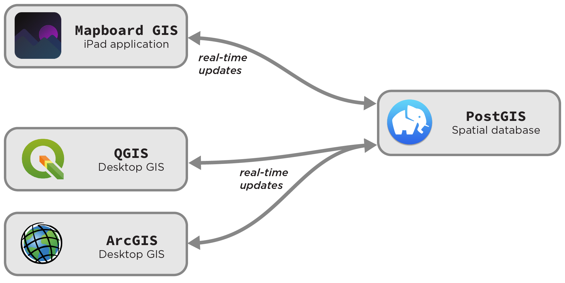
In Tethered mode, Mapboard GIS can turn over all spatial processing functionality to a centralized PostGIS database. PostGIS is an extremely popular and widespread open-source spatial database system that can be used within most modern GIS applications.
Offloading spatial operations to a server-side database has several advantages:
- It enables work against much larger datasets than an iPad can handle locally.
- It allows real-time interoperability with other GIS systems (e.g. drawing in Mapboard GIS can be paired with data cleaning in QGIS)
- It allows collaborative mapping, with multiple iPads tethered to the same spatial database.
The core spatial server
Topological functions are not required for a basic connection to PostGIS. In its simplest form, Tethered mode requires a connection to a networked server running Mapboard’s server extensions, or another server implementing the same external interface.
This server relies on a simple schema of four spatial tables
within a PostGIS database: linework, linework_type, polygon, and polygon_type.
These are the same core tables that drive the Spatialite backend (see file format docs). These tables
can be housed in any schema, but we use map_digitizer by default.
The correspondence between PostGIS and Spatialite table structure will eventually be expanded to drive “hybrid” workflows with managed syncing from offline mapping back into a broader project.
PostGIS with managed topology
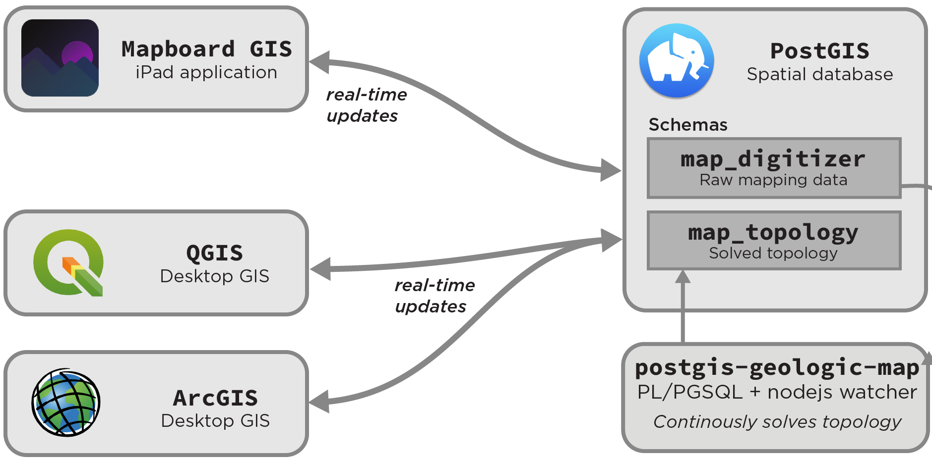
The most robust way to run a fully featured mapping server for work with Mapboard GIS is to use the PostGIS Geologic Map topology watcher. This software manages the topology of a geologic map iteratively, independent of the choice of GIS platform for making edits.
PostGIS Geologic Map enables iterative topological solving against the server-side data store for Mapboard GIS data.
PostGIS Geologic Map is designed to be testable, validated, and performant, and it serves as the basis for advanced topological operations within Mapboard GIS. Although the solver is agnostic to input GIS environment, the Mapboard server extensions are bundled by default.
geologic-map serve)PostGIS Geologic Map adds to the map_digitizer schema that tracks core map
edits with a map_topology schema that organizes the solved topological relationships
that make up the map. This schema can be regenerated at will, but progressively updating
its tables serves as the basis for the iterative map editing showcased in Mapboard GIS.
The algorithms that drive PostGIS Geologic Map are a key component of a draft manuscript that discusses the new methodology being developed here. Updates will come soon!
Installing the server components
Since both PostGIS Geologic Map (preferred) and the core Mapboard server extensions are server-side software, installing and connecting to them can be difficult. Both projects can be built from source by downloading the code from GitHub. Both can be installed locally or using Docker to manage the containerized app, including the requisite database server.
For PostGIS Geologic Map, the preferred server implementation, installation is well-covered in the README. The gist of creating a Docker-managed build (with test data) is as follows:
- Make sure Docker and
docker-composeare installed using the instructions for your platform. - Modify the
docker-assets/docker-map-config.jsonconfiguration file to suit your needs (typically, this involves changing thesridandtolerancefields). A better way to configure the application in Docker is forthcoming. - Run
docker-compose up --build. No need for a local PostgreSQL installation! - Connect to the
geologic_mapdatabase on local port54321using your GIS software or database client.
{
  "app": "mapboard-server",
  "version": "2.0.0",
  "projection": {
    "srid": 32733,
    "auth": "EPSG:32733",
    "description": "WGS 84 / UTM zone 33S",
    "projected": true,
    "proj4": "+proj=utm +zone=33 +south +datum=WGS84 +units=m +no_defs "
  },
  "topology": {
    "name": "map_topology",
    "srid": 32733,
    "precision": 0.1
  },
  "backend": "PostGIS",
  "capabilities": [
    "basic-editing",
    "reshape",
    "topology",
    "select-features",
    "topological-line-erase"
  ]
}
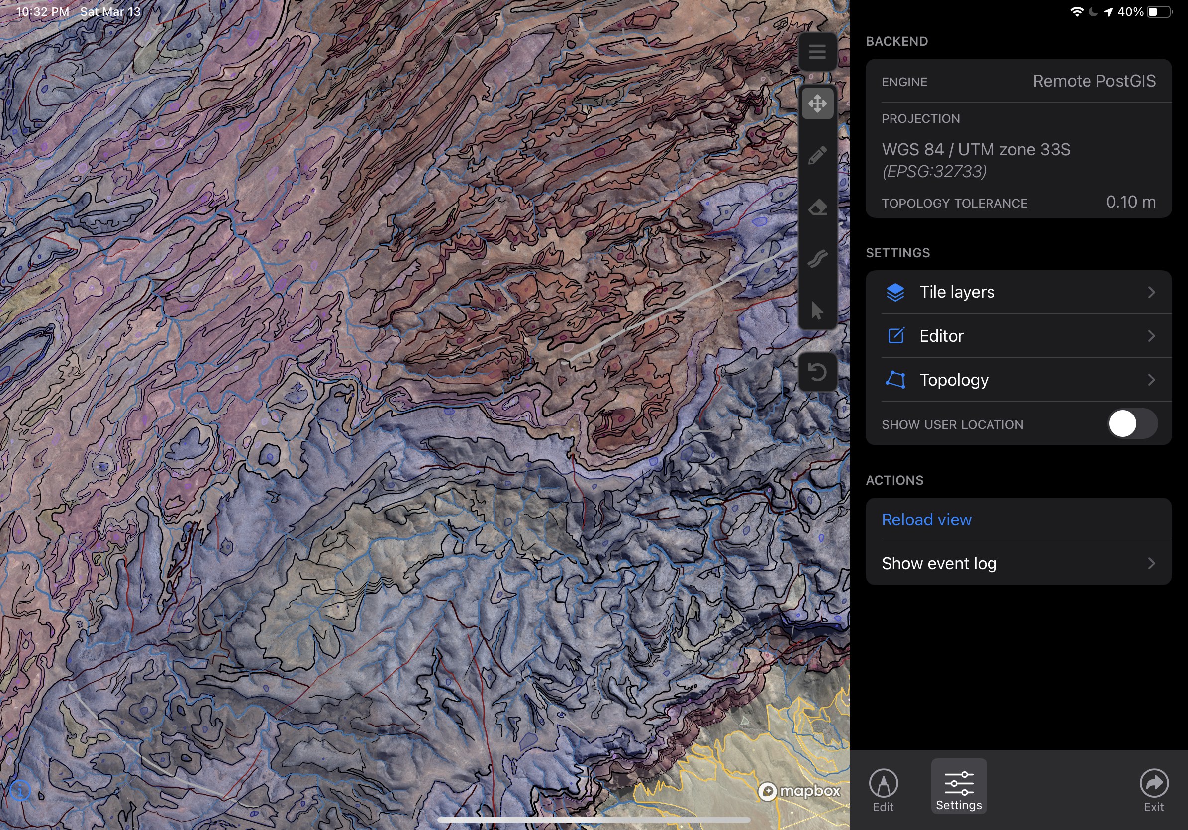
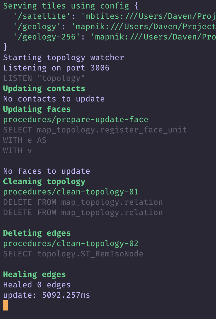
/meta requestOnce you’ve started the application, the Mapboard server should be running locally on your computer.
By default, the server is exposed on port 3006. You can verify this by navigating to http://localhost:3006/meta in your
browser. You should see a REST API response much like the one below:
This means you’ve successfully installed the Mapboard server! If you’re using the server without the PostGIS Geologic Map extensions,
the capabilities array will contain fewer entries. This tells Mapboard GIS to disable the corresponding functionality.
Connecting
The next step is connecting to the server from Mapboard GIS. If you are running the application on a publicly addressable machine,
the server will be available at <your-server-address>:3006. Otherwise you have to find your IP address or local network address.
On MacOS this is done in the Sharing panel of System Preferences. Alternatively, the raw IP address can be found using
the command ipconfig getifaddr en0
(on Mac and Linux platforms). Windows users, you’re on your own for now, sorry!
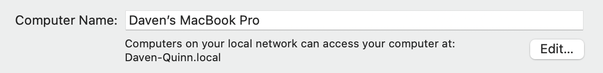
Daven-Quinn.local.
This is an alias for IP address 192.168.1.100, which changes as
my local router allocates IP addresses.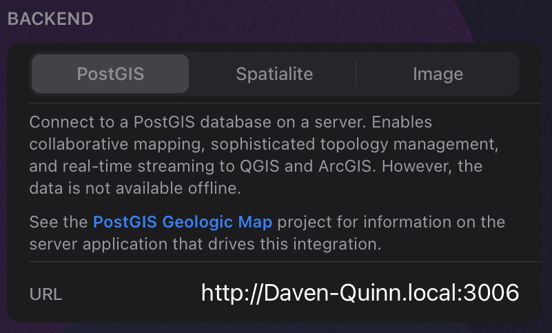
Once you have the proper connection string (e.g., Daven-Quinn.local:3006), you can connect in Mapboard GIS at the project
creation/editing interface. When the project is loaded, the app will begin talking to the server at that address to load linework and
handle editing.