Openness and interoperability
Mapboard GIS is designed by and for Earth Science researchers, and we’re hoping to be good open-science citizens. We are trying to build a focused tool which fundamentally rethinks one small part of the complex process of mapmaking in the geosciences. An important aspect of working on a targeted tool is forging strong links with other parts of the process, and accordingly, we want to make it as easy as possible to share data between systems.
We support an open system chiefly by using industry-standard, open-source formats for data storage and maintaining direct links to desktop GIS systems.
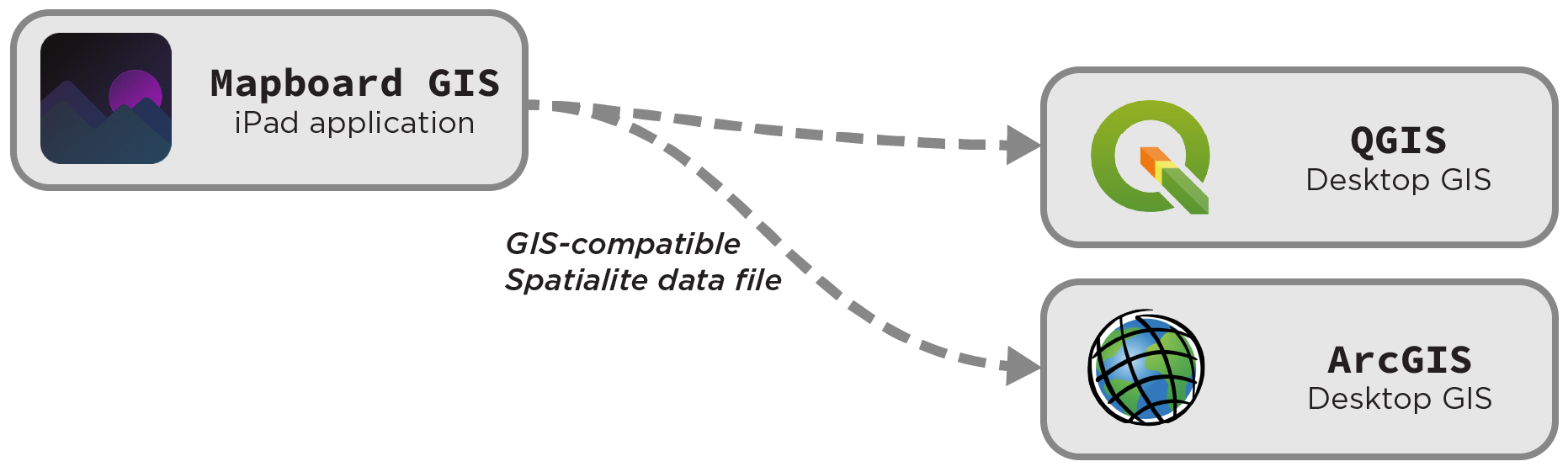
Open spatial database formats
The .mapboard-project files that back the app are
Spatialite databases can be directly read by
standard GIS systems (e.g., ArcGIS and QGIS). Metadata can be edited in
database browser applications such as SQLite Browser.
Direct links to desktop GIS
In tethered mode, data streams directly from Mapboard GIS into PostGIS, where it can accessed by other systems immediately upon creation.
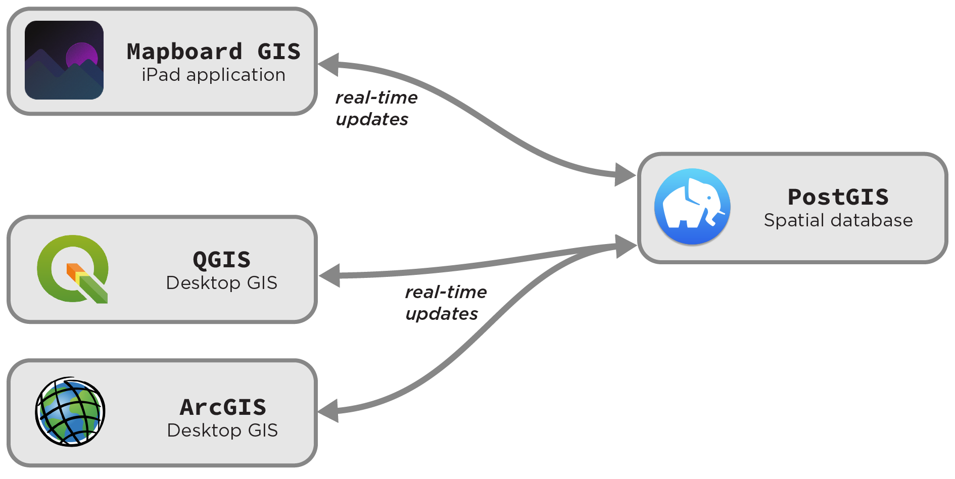
Since Mapboard works directly with spatial databases, no data import or export is needed for interoperability. This simplifies the app and allows it to work smoothly in concert with desktop GIS. Conversely, producing specific output formats like Shapefiles1 requires transformation using desktop GIS packages.
Next steps
On-device integration with other field apps
Geologic fieldwork is a complex and multifaceted activity, and one application will never fully capture researchers’ needs. There are many apps for capturing point-data measurements and outcrop images, for instance, and Mapboard GIS gains little from reimplementing that aspect of field workflows.
Eventually, we hope Mapboard GIS will become part of an ecosystem of interoperable apps for mapping, sampling, orientation capture, structural analysis, and stratigraphic measurement. This has been difficult to achieve on mobile platforms so far. However, in the last few years, Apple’s iPadOS platform has grown up somewhat to allow more multitasking capabilities, making the way forward a bit easier to imagine. For instance, with the recent opening of the iPad’s file-management capabilities, Mapboard GIS and other apps should be able to directly use files (particularly MBTiles basemaps) in each others’ application folders or elsewhere on the device.
Thoughts on open-source
Mapboard GIS is not (currently) open-source software. We understand the value of free software to open science, but we think that keeping our work close is a useful precaution right now. Building embedded systems is difficult and time-consuming, and we’ve seen relatively few iOS apps that have successfully built sustainable open-source models at this point.
We believe that Mapboard GIS can serve the goals of open science even as closed-source, subscription-based software. Since we rely on open file formats for data storage, the app will be at home within open-source workflows. Also, both the PostGIS Geologic Map project, the reference implementation for our iterative topology workflow, and the Mapboard GIS server components are open-source. These can potentially be customized to link the app with other projects as needed.
The Mapboard GIS codebase is structured to allow opening it in the future, should the requirements or our ability to support the project change. We’re open to adjusting our pricing model and management strategy going forward, especially if opportunities for code-level collaboration arise. Feel free to contact us with questions, concerns, or suggestions about our approach.
Footnotes
-
Even though you absolutely shouldn’t use Shapefiles. ↩